Posted in Sutherland

Underground again

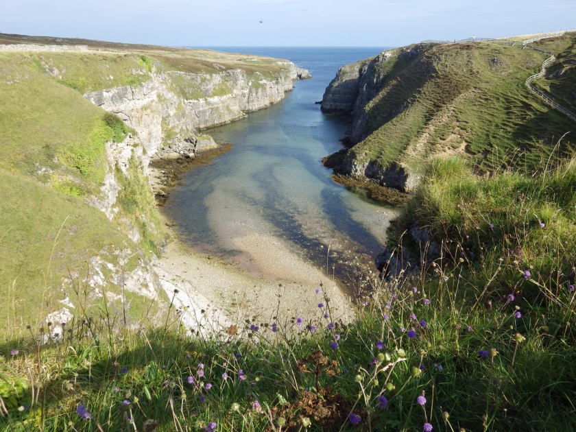
Writing about Smoo Cave in my last post reminded me of another underground experience I had in that area!
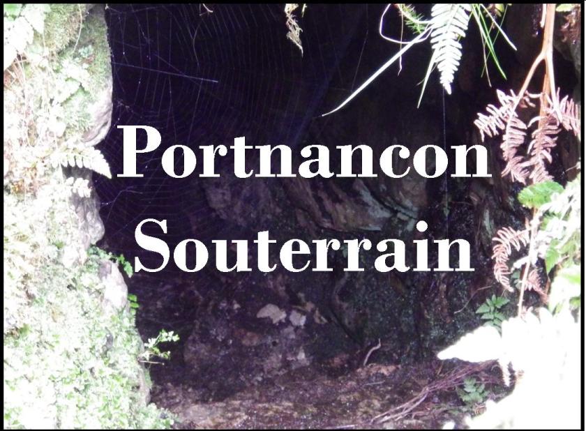
Not that many miles back along the coast is Portnancon Souterrain, an enigmatic underground structure that has survived since the Iron Age.

Souterrains were stone-lined, underground passages and in Scotland, were usually built underneath or beside Iron Age round houses. There had been evidence of a round house here in the past but this has since been destroyed.

There’s rarely anything left inside souterrains that would give any indication of what they were used for but they were most likely used as storage facilities. It’s possible that they could sometimes have been used for refuge or even for some ritualistic purpose but we will probably never know.

First find your souterrain
which is hidden on the heather hillside above Loch Eriboll

This was the very first souterrain I ever went inside and I didn’t know exactly what to expect. I lowered myself into the black hole, trying not to disturb the ubiquitous spider’s web – spiders love souterrains! Fortunately I like spiders.

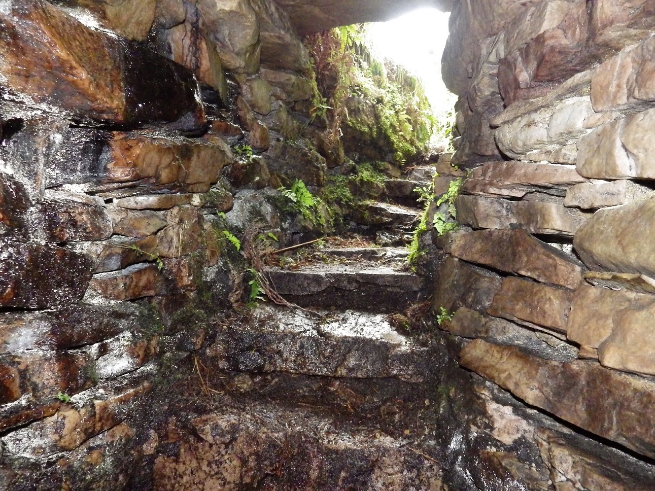
There were 12 steps leading down into the dark passage. . Like most souterrains, the roof was very low at the entrance but then got higher. I started to make my way along the curving passage and I must admit, it was quite scary when I turned the corner and was out of site of the entrance. I was now in complete darkness apart from the light from my torch.

The passage was over 8m long and curved in an anti-clockwise direction, culminating in a small rounded chamber. It has drystone walls and the roof is made from stone lintels.

As the end of the passage came into view I had a heart-stopping moment! I’d seen a photo of it, so knew roughly what it would look like. However, down there at the end of the passage I could see what looked like two ropes hanging from the ceiling, one of which appeared to have a sack suspended from it. This was disconcerting for a few moments but I carried on and investigated. It turned out they were just roots from the ground above which had woven themselves into this sack-like shape –  it looked quite eerie, though.

Heading back to day light.

Finding such a well-preserved souterrain was the catalyst for many more souterrain adventures, from crawling through muddy tunnels on the Isle of Skye to exploring spacious souterrains under Irish cashels.

Souterrains are found in Scotland, Ireland and Brittany and there is a handful in Cornwall, where they are called fogues. They can vary in size and design, from the small ones like Portnancon to much larger ones, containing several passages and chambers.
There is little evidence of any links between the regional variations and the concept of souterrain building probably developed independently in each of these areas.  Scottish souterrains date from the Iron-age, and often the round house has long since disappeared, leaving only the preserved souterrain underground.  Ireland has about 3,500 and these are much later, with most of them being from the middle of a period from the 6th-12th centuries AD. They are often associated with raths and cashels.
.
They are often discovered by farmers when ploughing and there was even one discovered near me when a tractor wheel suddenly went down into a deep hole. It turned out that it had gone through the roof of quite a large souterrain!


Posted in Sutherland

Around Durness – Smoo Cave and Ceannabeinne Heritage Trail

Following on from my last post from the Sutherland coast, I had to mention the incredible Smoo Cave, which is only 2 miles along the coast road from Ceannabeinne and a highlight on the NC500 route.
The title photo was taken from the ground above the cave.

Ceannabeinne Heritage Trail

But before that, you pass the Ceannabeinne Heritage Trail, which takes you around the site of an abandoned village, cleared during the Highland Clearances. Sutherland suffered badly during the Clearances, when landlords evicted tenants to make way for sheep, often in very cruel circumstances.

Ceannabeinne had been a thriving crofting community, with 14 houses and a population of around 50, but in 1841 the landlord served an eviction notice, giving the people only 48 hours to leave their homes and their land for good. Rioting ensued but the people were still forced to leave and all you can see now are the outlines of some of the buildings.

SMOO CAVE

The spectacular Geodha Smoo, where the sea has cut a channel through a weakness in the limestone and created this long chasm, culminating in Smoo Cave. Geodha is the Gaelic word for a chasm or inlet cut into the rocks and originally comes from the Norse word gjá  meaning a chasm or gully. It’s the most commonly used place name element for such features around the north and west coasts of Scotland and you’ll see plenty more geodhas, or geos, on the OS maps, but it would be hard to find one as impressive as Smoo!

The road passes over the roof of the cave system and from the car park there are steps down to sea level and a footbridge across the channel where the tide comes in.

The huge entrance to the cave is the largest entrance of any sea cave in Britain.

Leading off from this cave, which was created by the sea, are two more chambers but these are freshwater chambers created by rainwater seeping through and dissolving the rocks underneath. One of them has a 20m high waterfall pouring into it.
Smoo Cave doesn’t compare in size with the extensive cave systems like Aillwee Cave in County Clare or Wookey Hole in Somerset, which I’ve also been to, but it is still very impressive.

A footbridge leads to a landing stage where you can go in a small inflatable to explore inside the inner chambers. It was a short but exciting boat ride and I was so busy taking in what was around me and what Colin the guide was telling us that I didn’t take any photos! Something I regret now.

Creative Commons Attribution-Share Alike 3.0 Unported license. by J budissin

Archaeologists have found evidence that the cave had been used in prehistoric times and have uncovered artifacts from Norse and Iron Age times. Carbon remains were dated back to the Neolithic period and it’s thought likely that the cave was used as far back as the Mesolithic period.

Back up on the road, we saw this very neat peat stack.

I took a photo of it because I’m not used to seeing peat stacks on a fertile limestone landscape!  I also liked the assortment of recycled containers for the plants!
The landscape along the coast here can change dramatically from one geological era to another and I don’t think you have to be a geologist to notice the sudden changes from one rock type to another.  This is due to a series of fault lines where blocks of rock had moved vertically and left the relatively young Durness Limestone lying adjacent to the older Cambrian quartzite, which in turn, lies next to the much older Lewisian Gneiss. The peat had probably been cut on the moorland where the bedrock was gneiss.

A splash of colour.

Next to Smoo Cave is Durness Smoo Youth Hostel and there was a colourful display of flowers in the adjacent garden.

There’s plenty more to see as the road carries on through Durness, the most north westerly village on mainland Scotland. That will have to be for another post, though!