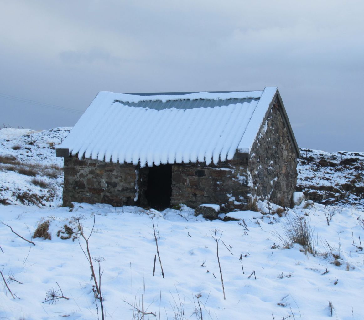
Posted in Anglesey, Donegal, Highland, Western Isles

Through the seasons

December on the Hebridean Way.

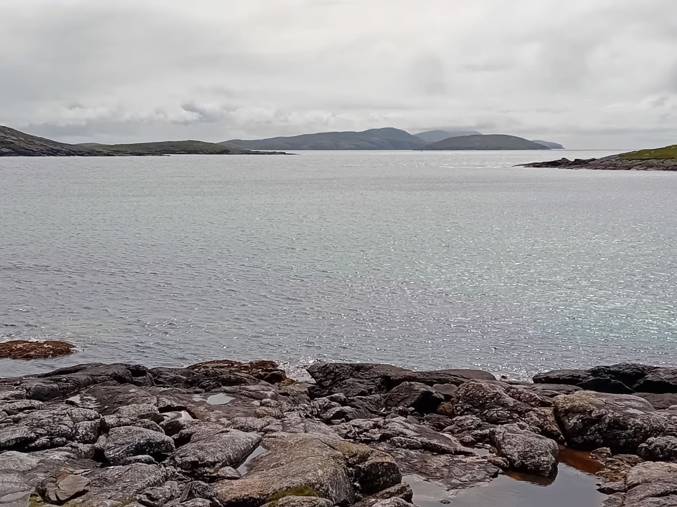
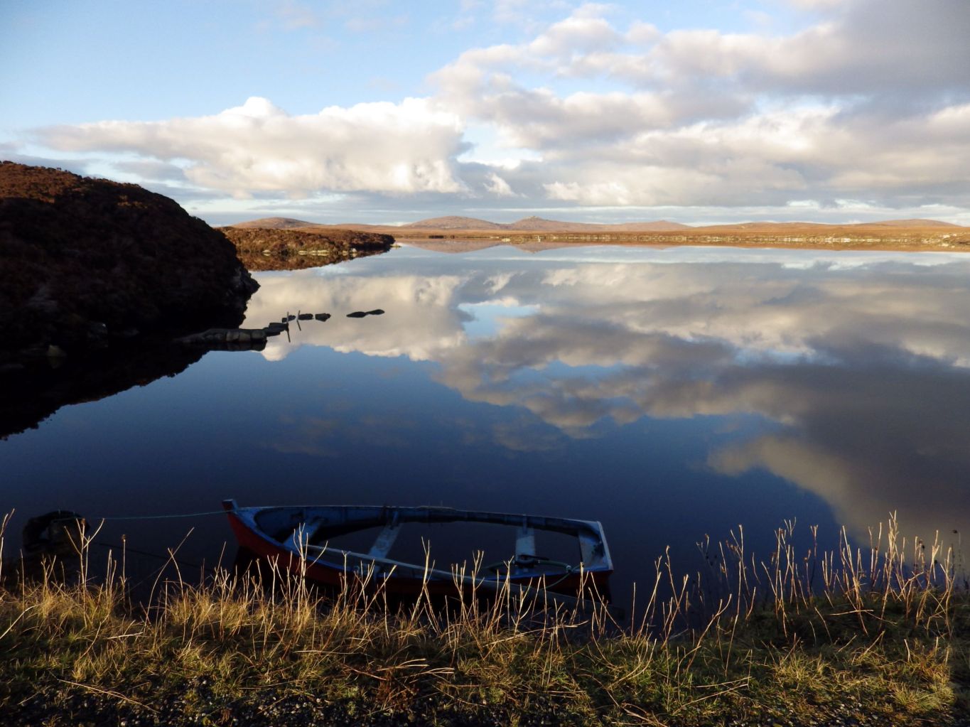
This part of the Hebridean Way is in North Uist, where the path skirts around the summit of Beinn Langais before heading east towards Lochmaddy.
When the sun comes out the moors are ablaze with colour.


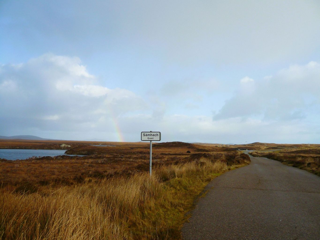
The path descends to the main road across North Uist and crosses over it to join the the old single track road. 
After the new double track road was made, some new passing place signs appeared on the old road! This one says Sàmhach (quiet) and others say Ciùin (calm) and Sitheil (still). It’s easy walking and very peaceful.

Passing through a landscape of lochs and moorland

Spring

Penmon, Anglesey

On the eastern tip of Anglesey the coastal path goes past Penmon Priory, which is well worth a look around. Across the water are the mountains of Snowdonia.

A monastic site was established here in the 6th century and the priory, which was built in the 13th century, survived the dissolution of the monasteries and is still a parish church today.

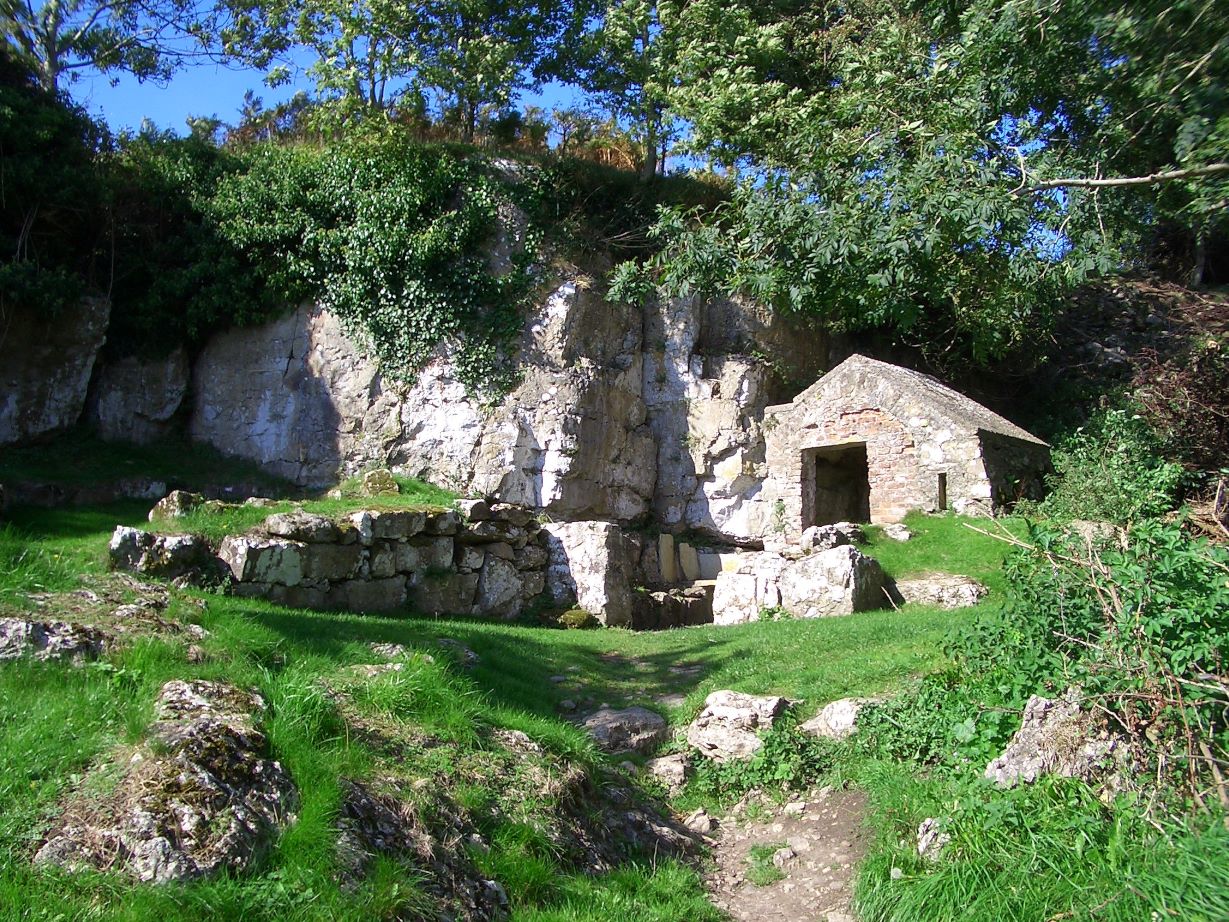
St Seiriol’s well in the secluded walled garden.


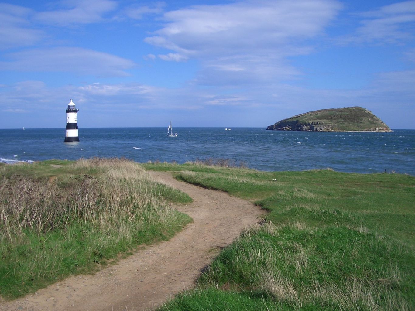
The path follows a mile long toll road and at the end is a beach and the picture postcard scene of Puffin Island and Penmon lighthouse.
The monks at Penmon also had a small community on Puffin Island and one of their sources of food was puffins. They were also reported to have done a very good trade in pickled puffins!

Summer

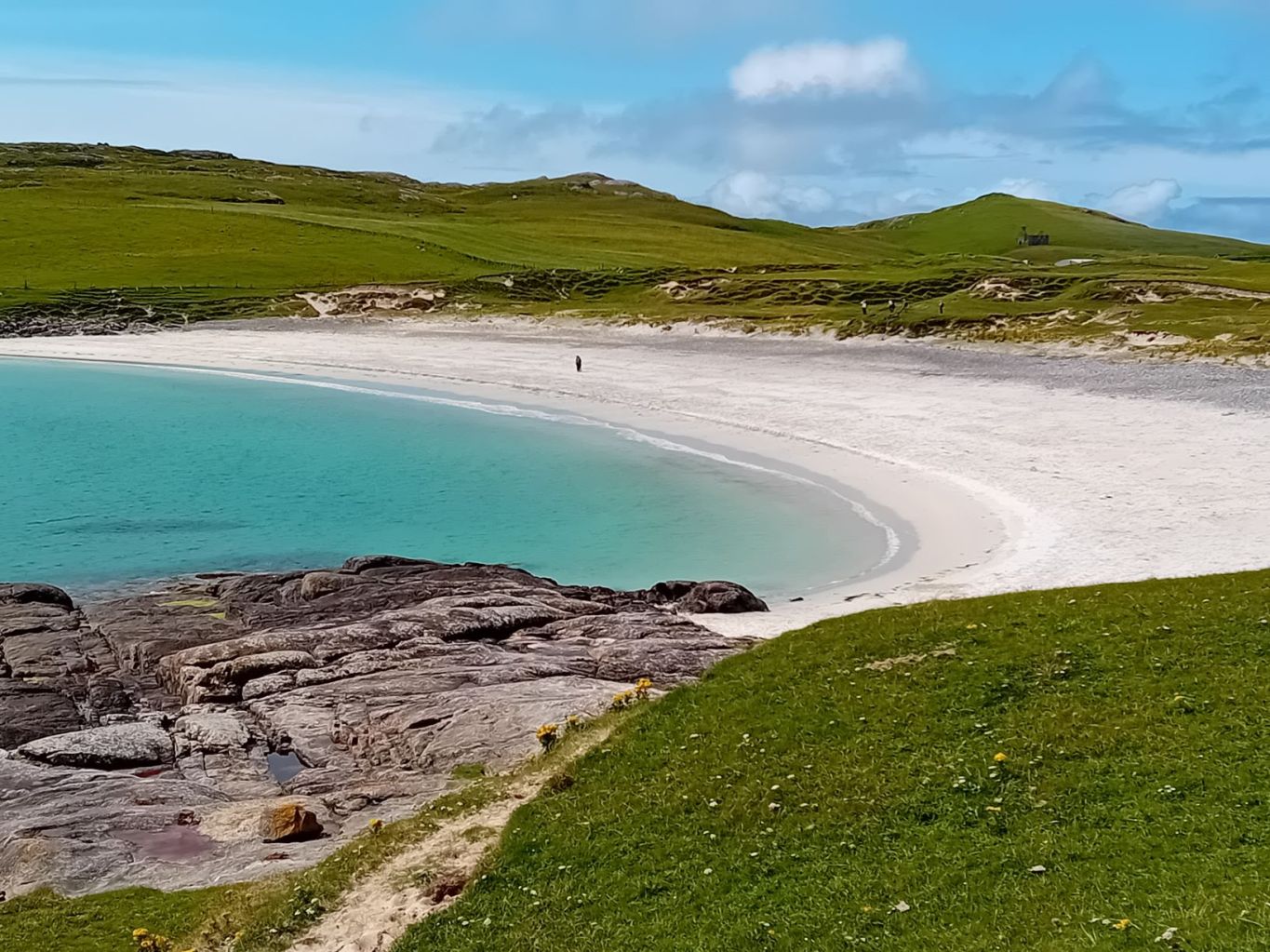
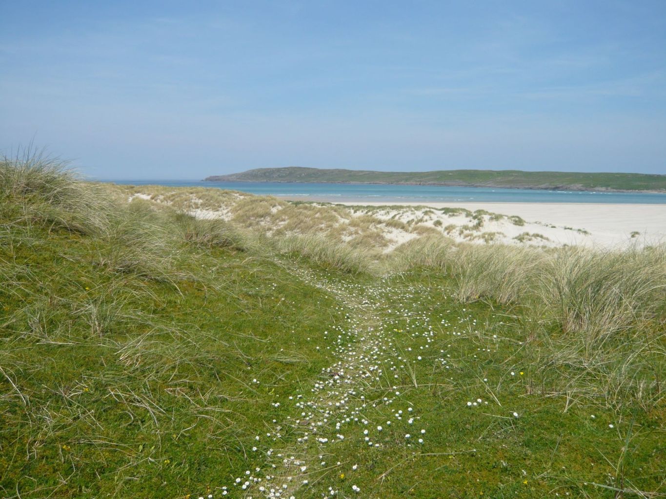
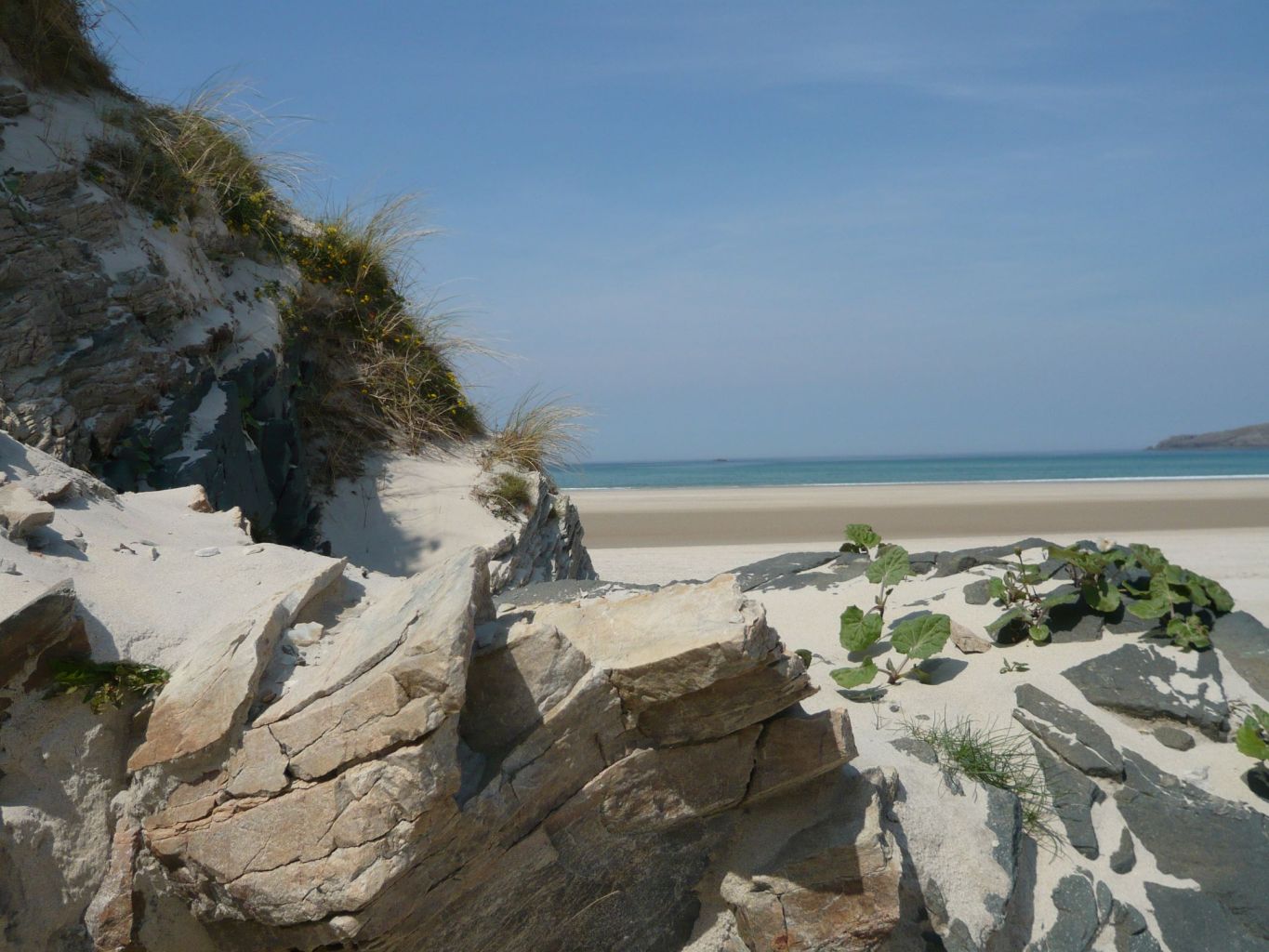
Maghera Strand, Donegal

Hot summer days walking on the beaches in West Donegal, or more often, paddling from one end to the other!

Path to the sea

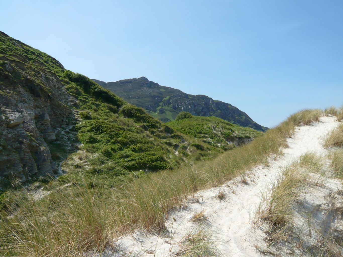
The rocks here are Dalradian quartzite and when they’re eroded by the sea they form the beautiful white sand.

Where the mountains sweep down to the sea

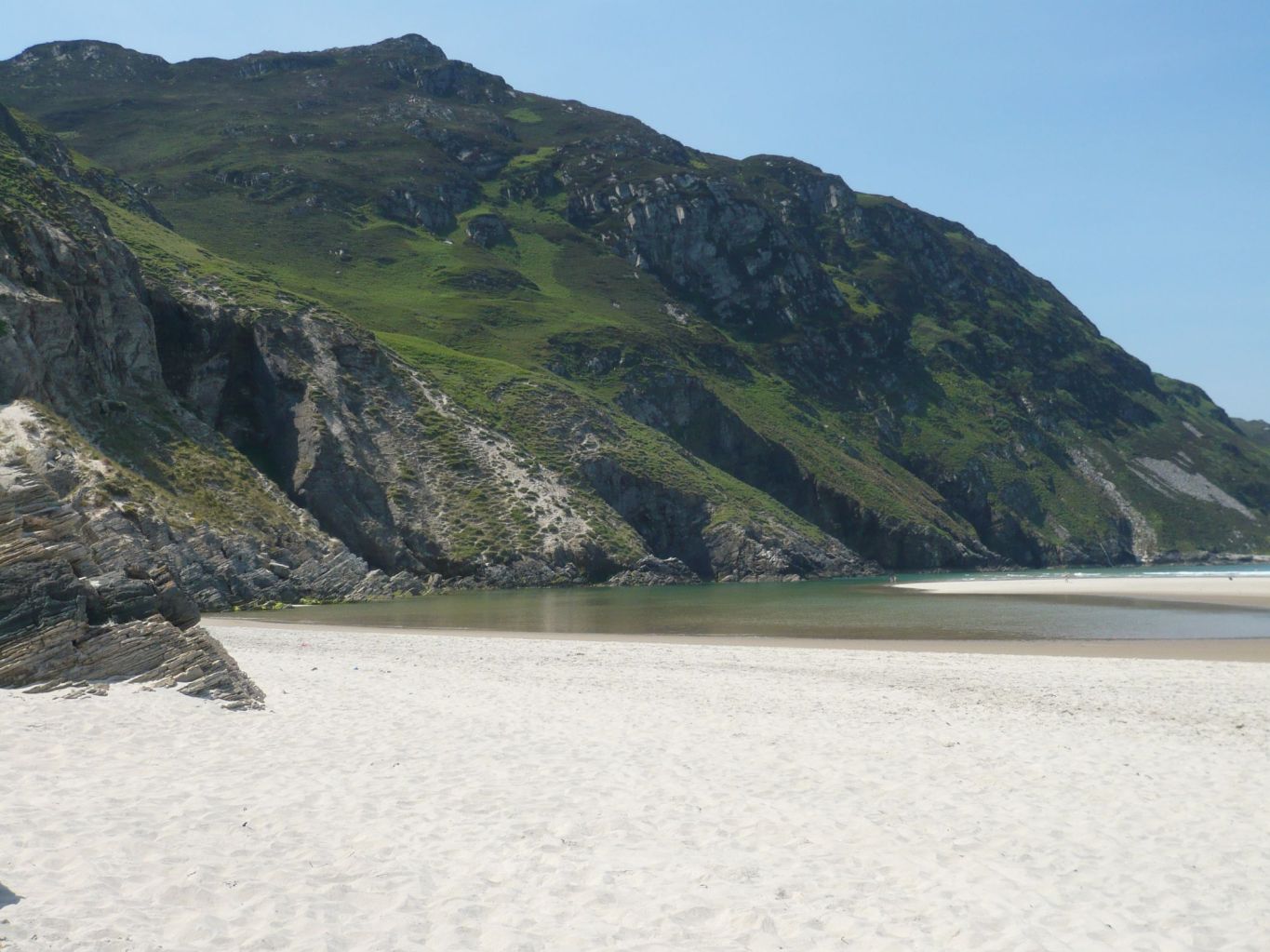
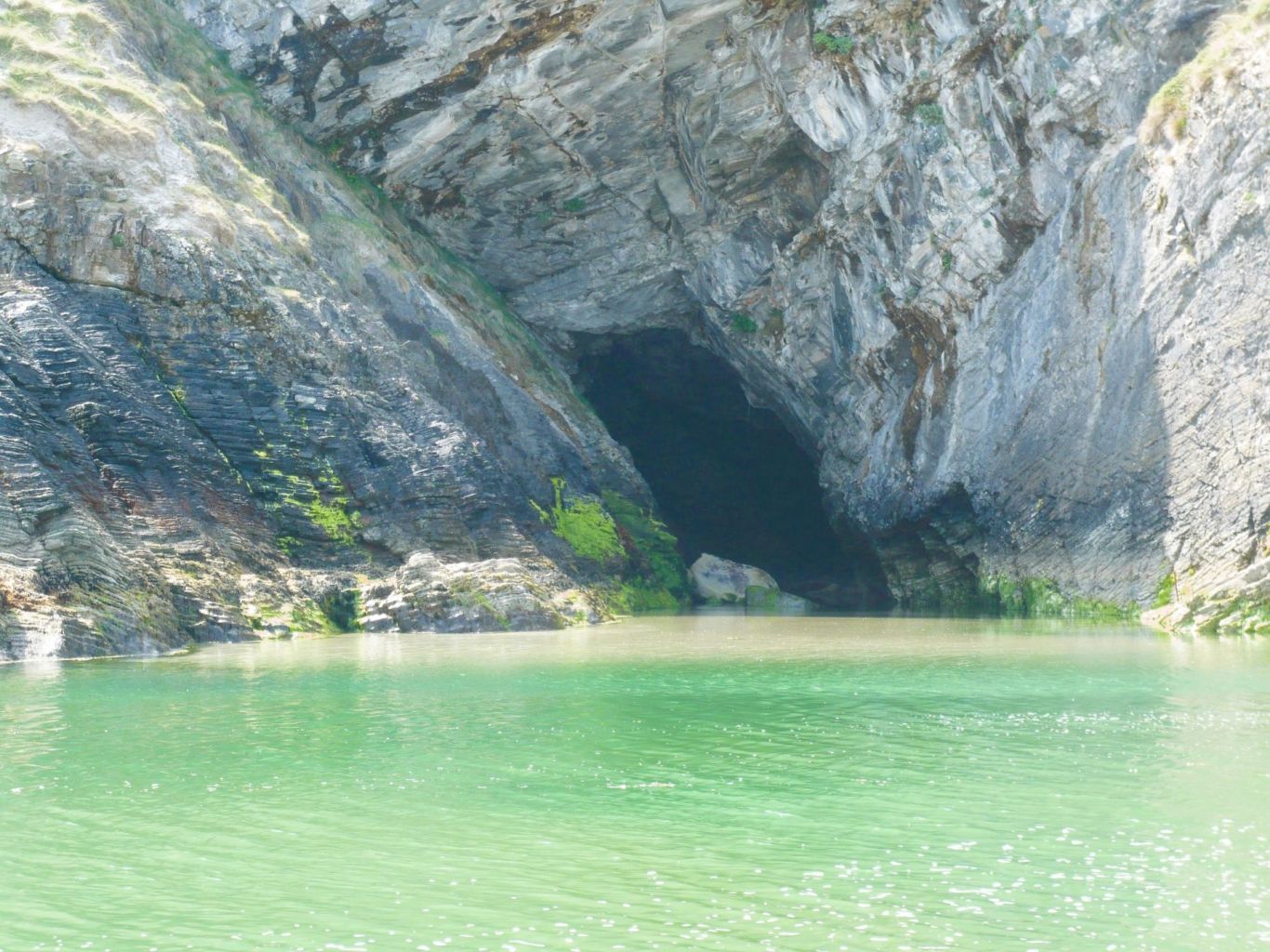
Sea caves filling up as the tide comes in.
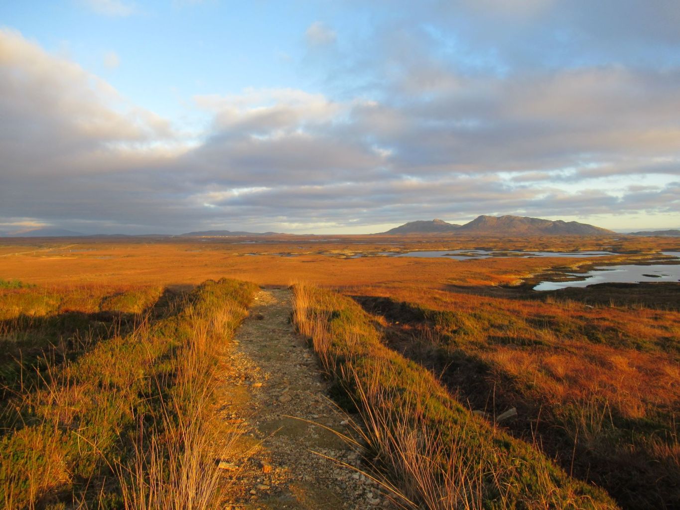
Autumn

Corrimony

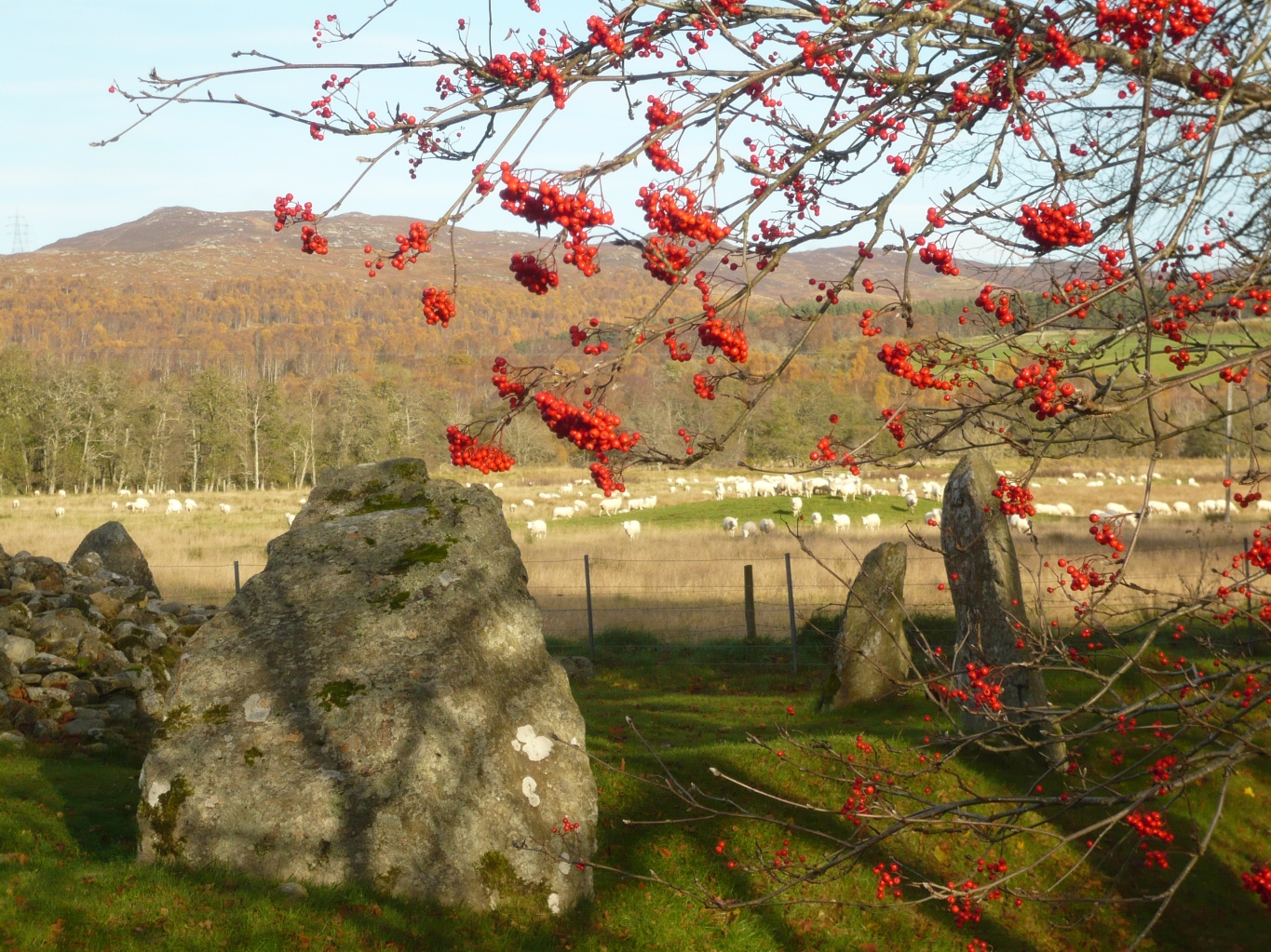
Glen Affric is the place to see autumn colours but just before reaching Glen Affric is a road  to the upland valley of Corrimony. It’s a much less frequented place but has a number of historical sites and an RSPB reserve.

We were there to see the Neolithic Cairn but spent a day walking in the area and hardly saw another person.

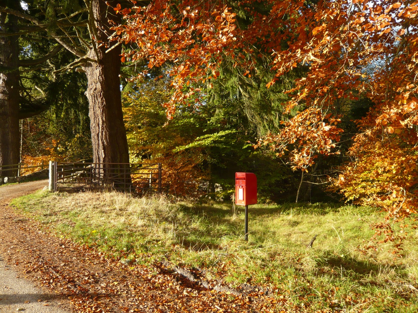
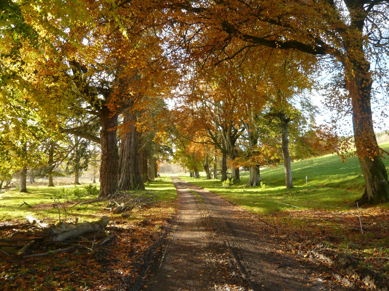
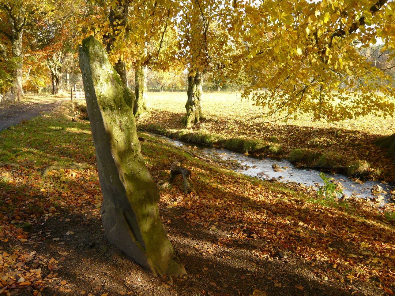
Where the road comes to an end there’s a formal avenue of trees that was once the driveway up to New Corrimony House, a baronial style mansion built when Corrimony was a prosperous Victorian shooting estate. The house burnt down in the 1950’s and only a few traces remain.

Beside the old driveway is Mony’s stone, said to have been erected in Viking times to mark the burial place of the son of a Danish king.

and back to winter …

Posted in Western Isles

The Deserted village of Eòrasdail

On a rainy summer morning we set off to walk to the deserted settlement of Eòrasdail on the island of Vatersay.

Vatersay is the most southerly inhabited island in the Outer Hebrides and  since 1991 it has had a causeway linking it to the larger island of Barra.

The weather was forecast to improve but as it was so wet to start with we were tempted to call into Bùth Bharraigh, the community shop in Castlebay, for a coffee.  We lingered over our delicious fairtrade coffee and homemade date and oat slice then picked up a few extras for our picnic, including some wholefoods from the self-service ‘refillery’.
By the time we left, it was much later than we’d intended!  The rain had stopped and it was warm and sunny as we drove across the causeway onto Vatersay.  

Looking down onto Vatersay’s West Beach

We passed the East and West Beaches where the north and south of the island is joined together by a stretch of machair with the sea on both sides.

From the village we headed south, following a sandy track across the machair.  It wasn’t long before the South Beach came in to view. It was completely  deserted and it was tempting to stop here for a while and have our picnic lunch but our plan was to carry on to the deserted village and have our lunch on the little beach there.

It was a day of very mixed weather and clouds rolled in soon after leaving the South Beach.  The sea and the sky turned grey and it rained for a while.

Looking south towards Pabbay and Mingulay

We made our way eastwards, climbing a couple of small rises until we had our first glimpse of the deserted village, nestled in an area of grassy machair between two rocky hillsides.

Whichever way you approach Eòrasdail from it’s a strange site, with a collection of gable end walls and some chimney stacks rising out of the machair.  Only one house with intact walls remains. On a misty day it can look quite eerie.

The only house with 4 walls still standing

The houses were built during the early decades of the 20th century and unlike the old black houses with their thick stone walls and thatched roofs, most of the houses here were built of corrugated iron or wood, with only the gable ends made of stone.

The stone gable ends and their fireplaces are still standing but the other walls have long since disintegrated.

The Vatersay Raiders and the origins of the settlement

The settlement at Eòrasdail was originally established by fishermen from Mingulay  who had no land of their own and who’s life had become desperate and unsustainable  due to pressure for land and other difficulties such as the lack of a pier and safe landing place. For years they had been pleading with the absentee landowner for some land on Vatersay  to grow crops and graze their animals  but this was never granted. In 1906 they  moved onto Vatersay and invoked a supposed old law that stated that they they had the right to settle if they built a dwelling and lit a fire in it within one day.

They became known as the Vatersay Raiders because they had settled there illegally and had built huts and planted potatoes without permission and remained there despite interdicts served against them by the landowner, Lady Gordon Cathcart.

 They had been joined by men from Barra who were in a similar predicament but in 1908  ten of the men were summoned to court in Edinburgh because they refused to leave. They were given 2 month prison sentences but there  was a great amount of public support and sympathy towards them and in the end the government was persuaded to buy the island and divide it up into 58 crofts.

Land was allocated throughout the island, including at Eòrasdail, and the population started to rise again.

Off all the new settlements on Vatersay, Eòrasdail was the least popular because of it’s remote position. When there was a scheme to build paths and jetties for the different townships Eorasdail missed out. It was neglected again in the 1950’s when there was a road building scheme on the island.  It never got a proper path, let alone a road, to connect it to the rest of the island. The last house was built in 1936 and by the late 1960’s the village was abandoned due to its remoteness.

Just below the houses is a pebbly beach. We had our picnic here and then walked to the next bay where there was a small sandy beach.

Leaving Eòrasdail, we retraced our steps back the way we’d come so we could return to the South Beach. By now the sun had come out again and the beach looked glorious.

Heading back across the machair to Vatersay village.